WATERFALL CIR
Long creek village was named
after the creek, called Stone Cir 100 m. through the mid-high cliff of a
waterfall look nice. Water 50 m dropped from a height of the lower side
of the rocky creek bed, which has a beautiful outlook. 8 km from the
center of Ilica endless. be reached in two different ways away from the
waterfall. Cir stone cliffs and caves are found in the region that also.
This is more cliff live birds of prey.
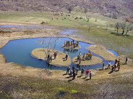
İÇMELER

Bingol-Young
road 9.km. Sinden. Other seasons except winter season from morning
until evening on the water, local and foreigners constitute a large
crowd. Such water, chronic rheumatism, gynecological diseases have been
identified and proven to reduce kidney stones.
Bingölün mountains, plains, lakes and streams
MOUNTAINS

Bingol
very mountainous terrain. Heights in excess of 3000 meters is located
in the mountains. On the heights of mountains, plateaus and plains in
fall 2000 meters down. There are even places on the nature of the plain
1000 meters .. Four sides of the mountain is surrounded by the
boundaries of the plain of Bingol. Parts of the mountains, high peaks,
glacial lakes and the remains of purple skirt portions of the
containers. Are usually sparsely forested mountains, some parts of the
southern parts of the naked. Where are they found oak forests of the
mountains down to 1800 meters.
Hiç yorum yok:
Yorum Gönder